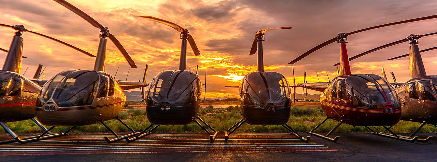
Advanced Aerial Intelligence and Visual Solutions in Tuscaloosa
Strategic Aerial Perspectives Over Alabama
Tuscaloosa Helicopter Charters delivers comprehensive aerial intelligence solutions across Alabama, precisely tailored for diverse survey requirements. We facilitate advanced data acquisition through specialized operations including magnetometer and electromagnetic surveys, LiDAR scanning, and sophisticated GIS mapping. The inherent agility and precise maneuverability of helicopters, encompassing low-altitude flight and stable hover capabilities, are critical for capturing highly accurate and detailed geospatial data. Furthermore, we excel in providing specialty aerial filming services, enabling access to cutting-edge cinematography and photography technology, alongside practical configurations such as door removal for optimal handheld perspectives. For any aerial data collection or visual documentation needs above Alabama, our extensive options offer unmatched precision and operational flexibility.
Aerial
Surveys
LiDAR, GIS Maps, FLIR, HD Video & More
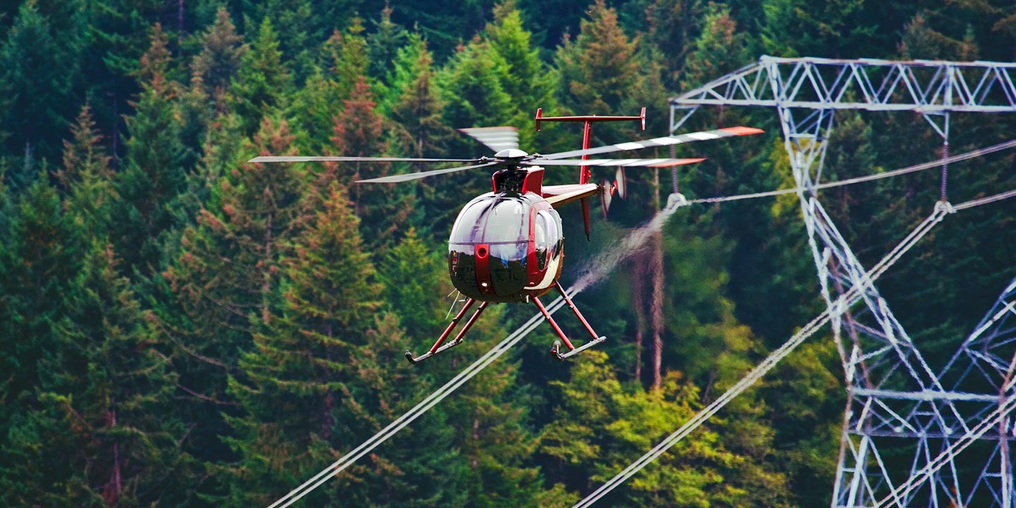
Tuscaloosa Helicopter Charters offers indispensable aerial support for critical infrastructure integrity management, from precise pipeline surveys and detailed Right-of-Way inspections to proactive transmission line diagnostics. We facilitate access to optimal rotary-wing aircraft and specialized sensor equipment, ensuring accurate and efficient project execution across Alabama’s complex infrastructure.
High Tech Results
The Top Pilots in Alabama, Today's Technology... Maximum Results.
Call 1-866-826-4826 Now!
Tuscaloosa Helicopter Charters provides the tools needed to complete your land surveys, utilizing the right equipment to provide the aerial photos that are often needed.
Strategic helicopter-based aerial surveys are instrumental in simplifying complex Right-of-Way and site inspections, enabling precise topographical data acquisition, and facilitating high-definition photographic documentation for critical commercial projects. Leveraging the inherent agility of rotary-wing aircraft provides the optimal platform for meticulously examining Alabama's varied terrain, conducting thorough pipeline integrity assessments for leak detection, and identifying anomalies within extensive transmission line networks. Tuscaloosa Helicopter Charters specializes in engineering bespoke photographic and advanced remote sensing operations, meticulously customized to maximize both technical efficacy and financial efficiency, ensuring superior data yield and actionable intelligence for your enterprise.
The unparalleled operational envelope of rotary-wing aircraft makes them the definitive platform for precise aerial surveying, significantly surpassing the capabilities of fixed-wing alternatives. While Federal Aviation Administration (FAA) regulations mandate fixed-wing aircraft maintain a minimum altitude of 1,000 feet above obstacles, helicopters possess the unique ability to operate at much lower altitudes, even achieving stable hover capabilities. This critical advantage enables meticulous inspection of challenging or hazardous zones, providing engineers and project managers with invaluable, high-fidelity data and perspectives unattainable through other aerial means, especially for complex projects across the Tuscaloosa region.
There is no better way to conduct your visual survey, animal population counts, soil drainage analysis, ROW inspections, pipeline and transmission line inspections, and geographical surveys.
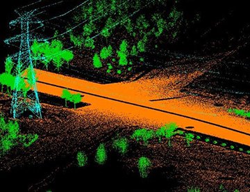
LiDAR Imaging
Light Detection and Ranging, or LiDAR, is a remote sensing method used to examine and measure Alabama topography as well as objects, like vegetation, upon it.
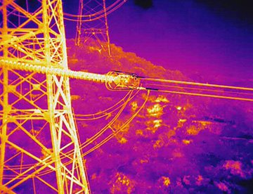
Infrared Imaging
Thermographic IR cameras are used to detect radiation in the long-infrared range of the electromagnetic spectrum and produce images of that radiation, called thermograms.
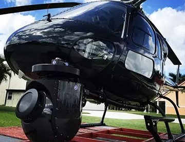
HD Video Gimbal Capture
Modern HD and 4K cameras can be mounted to helicopters, using the proper STCs, with a gimbal to stabilize photos & videos for detailed results.
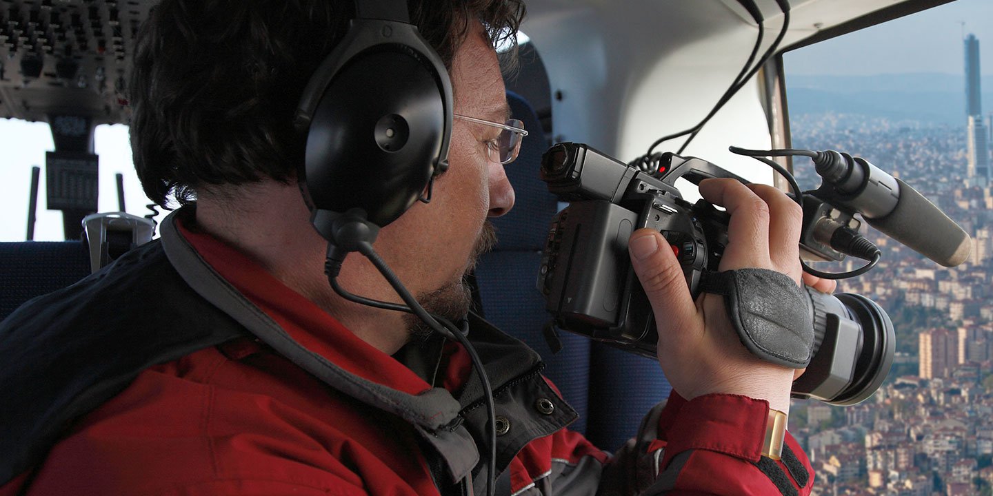
Precision Aerial Cinematography and Visual Content Capture
For expert camera work in the Tuscaloosa Sky
Get a Fast, free QuoteTuscaloosa Aerial Cinematography
Tuscaloosa Helicopter Charters provides unparalleled access to a full spectrum of resources for professional-grade aerial cinematography across Alabama. We facilitate the deployment of cutting-edge technology for custom productions, including sophisticated gyro-stabilized camera mounts such as Tyler Mounts, Wesscam, Cineflex, Pictorvision, and SpaceCam, integrated with high-performance specialty cameras like Cineflex HD, RED Epic, and Arri Alexa, alongside advanced 3D and experimental camera systems. Our comprehensive support extends to all facets of your production goals, from dynamic air-to-air sequences to intricate ground-to-air shots. We understand the critical importance of synergy between flight operations and your aerial Directors of Photography and directors, ensuring precise maneuvers that translate artistic vision into compelling visual results. Specializing in rotary-wing platforms optimized for both still and motion photography, Tuscaloosa Helicopter Charters is equipped to support nearly every media-related operation throughout Alabama, encompassing feature films, television series, documentaries, promotional videos, commercials, specialized aerial props, rapid response for news networks, and comprehensive coverage of significant historical and major sporting events with a diverse fleet of helicopters.
Call Us Today at 1-866-826-4826 for a Free Quote
Contact Us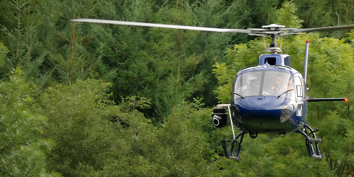
Aerial Photos
Hand-held or Mounted OpTions in Tuscaloosa
We will help you get the right equipment for your aerial photography project! Call 1-866-826-4826 today to get a fast, free quote.
The Most Options for Photography
Capturing the breathtaking landscapes and significant architectural features of Alabama is optimally achieved from an elevated aerial perspective. Tuscaloosa Helicopter Charters provides meticulously tailored aerial photography charters, engineered to facilitate the precise realization of your visual objectives and exceed professional expectations. We are committed to delivering highly cost-effective and accessible photographic opportunities across the state. For dynamic, handheld projects, many rotary-wing aircraft can be configured with door removal, offering unobstructed fields of view. For applications demanding paramount stability and precise control, advanced gyro-stabilized camera mounts are available, ensuring professional-grade imagery and exceptional technical results for even the most challenging assignments.
Superior Service
Every one of our customers gets a dedicated helicopter expert to assist with flight plans, tech loadouts, production logistics, project schedules, and other demands.
Over 500 Aircraft
Our network of direct air partners extends well beyond Tuscaloosa, Alabama. This allows us to offer a wide range of solutions for even the most sophisticated projects.
The Best Equipment
From high-tech sensors like LiDAR, FLIR, and GIS to HD cameras and movie production gimbals, we're here to make your job as easy as possible.


